Tuesday, May 5, 2009

Now you can glow, too

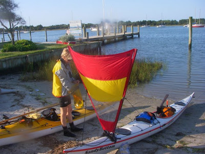
In a previous post I chatted about a new product called Glowfast Luminous Sail Tape and how useful this tape would be on my Pacific Action Sail when paddle/sailing at night.

The company's based in Oz, and Jason from Glowfast e-mailed me, writing that he'd break up a 40mm roll for me, as all I'd need would be about four metres.

Jason's happy to give this short-ordering system a go, so if you too would like to order less than a full roll of 25 metres, you can e-mail him at jason@glowfast.com, and easily pay via PayPal (whether you have a PayPal account or not).

I look forward to testing the tape out when it arrives from my near-neck of the woods!

Friday, May 1, 2009

A grand wee adventure: part III

SandyBottom and I had planned a three-day, 100-mile (160km) sea kayak trip to scout for our September WaterTribe North Carolina Challenge. Using Top Spot chart N239, this is our story…

Dawn’s cough woke me, to a still morning—the wind had finally died—and a red ball was peeking above the Outer Banks, too low to fully see in the distance. But we could hear… the humming of a thousand—possibly more—mosquitoes, inside our tent flys and out—starving for blood—as big as sparrows. And I am not exaggerating. (North Carolina Challenge 2009 contestants: be warned!)

I dressed in my evening fully covering clothes and did all my packing, etc business inside the tent (thankgoodness for WagBags). Unzipped the inner at the last moment, threw everything out, donned headnet, threw down the damp tent, and furiously packed our boats. If I stood still for long enough, my cream socks turned black. I knew there were mozzies still inside my tent, and inside my hatches when I closed them tight—I did not care.

Finally braving the beasts to throw off morning clothes, we speedily donned paddling clothes and pushed off the beach, still wearing our headnets. (The next day Dawn e-mailed me at work to report she’d counted 300 bites all over her body—I had much fewer, but where I had been bitten turned into large red lumps.)

Homeward bound we paddled, past Rumley Bay and Lola Point, tucking around Cedar Island Point. The WSW slowly kicked in, and with our sails up we made good progress.

We discussed a note to take photos to warn fellow NCC contestants, particularly in the bigger boats, to stick to the marked channels, as the fish net stakes are common around the coast here, sometimes stretching a hundred metres and more from the shore, offering a dangerous addition to nighttime travel.
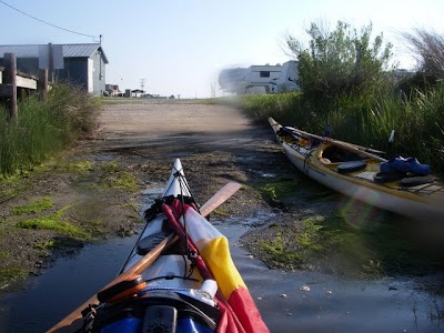
We’d had plans to end the NCC inside Cedar Island Bay with the finish line right in front of the Driftwood campground at a small boat ramp there. But with the tide down and the difficulty of finding a channel even with the tide in, we’ve decided to have everyone finish right where we started, outside on Pamlico Sound. And if the weather’s really hammering the Sound, folks can make the decision to finish inside; where we did, just a couple of hours after leaving the newly named, Blood-Letting Point.

Freshly showered and changed, we drove home via Beaufort for one of El’s shrimp burgers with all the works—a fitting end to a grand wee adventure!

Thursday, April 30, 2009

A grand wee adventure: part II

SandyBottom and I had planned a three-day, 100-mile (160km) sea kayak trip to scout for our September WaterTribe North Carolina Challenge (NCC). Using Top Spot chart N239, this is our story, part II…

The sun was just rising as we quickly packed and headed off, paddling across the current, through the Newport Marshes, to the T-junction where the IntraCoastal Waterway meets the channel into Beaufort. Near 0800 we passed aside Beaufort’s drawbridge—being raised at just that time for a couple of large launches—and made our way around the point and into Taylors Creek—with the current.

It’s always a fun time paddling past the Beaufort marine front, with the maritime boat shed, marinas typically full of craft of all sizes and budgets, and someone to wave and say hello.

We pulled into Graden Paul Park, which will be CheckPoint 1 for September’s North Carolina Challenge—a very nice sandy beach for the kayaks, and a solid jetty for the larger boats. It’s a two minute—if that—walk to the nearest café, water and, I remembered, our favourite weekend breakfast brunch, which we took advantage of! Very civilized—though we made sure to sit on the terrace adjoining the marina, upwind of other diners.

Filling the bladders with another few litres of water, off we headed, nearly salivating with delight with the day's anticipated tail winds—how often does that happen?!

Out from Taylors Creek we decided to stay on the outside of Harkers Island to fully take advantage of the sou-wester, blowing a very nice 5-10 knots. Pacific Action Sails up for the broad reach, we ambled past the houses of Harkers, checking out the real estate. Needing a pit stop, we pulled into the Rangers Station at the far end of the island, momentarily confused by the new rip rap wall that now bars you from the entire beach, but offers a wee sheltered inlet to paddle in and make shore.

Around the tip of Harkers it’s a hard left on a NNE heading, right back up the inner coast of Core Sound toward Cedar Island.

The mantras for the rest of the day, as the winds slowly increased, soon became, from me, “Dawn, you need a rudder”, and from Dawn, “Kristen, I sure do need a rudder”. Relishing the conditions as the wind soon reached 20-22 knots over the afternoon, with the sail up I constantly cruised around 5-6 knots not even paddling, with a regular top speed of 9 knots. But with Core Sound’s shallow waters of just a metre or two off channel, the wind-pushed water can pick up a metre or so breaking chop pretty quickly. And without a rudder to take the pressure off keeping on course, SandyBottom didn’t have it as easy, we finally taking the sails down and completing the day the old-fashioned way.

Around 1600 we decided to call it quits—primarily because we didn’t want the trip to end too soon—Cedar Island and the finish were only a few hours away, and surely that could wait ‘til morning.

We pulled up at a sandy wind-swept point, lost my hat and spent some very tiring minutes against the wind retrieving it, dragged the boats up into the grasses out of sight, put up tents and changed—and very relaxingly lazed around chatting, waiting for dinner hour, accompanied with a few sips of Glenfiddich.

It was still quite daylight when we repaired to our tents, each watching the Sound slowly calm as the wind died—though it continued to buffet our tents well into the early hours. And for 12 or so hours, we slept like logs…

Wednesday, April 29, 2009

A grand wee adventure: part 1

SandyBottom and I had planned a three-day, 100-mile (160km) sea kayak trip to scout for our September WaterTribe North Carolina Challenge (NCC). Using Top Spot chart N239, this is our story…

After a comfy night camping at Cedar Island’s Driftwood campground, the boats were packed, prepped and ready for action ten minutes before the 0730 ferry departed beside us. Not a breath of wind, after a very gusty night—and it remained that way for the first four to five hours—absolutely still.

Our first ten miles (16kms)—on a course of 300 degrees—took us to the northern end of Raccoon Island, a bombing range for the military, complete with an abandoned super hull in the middle of an inner bay, sadly awaiting its purpose as target practise. Tucking around the point, but far off enough to skirt the restricted zone, we entered the Neuse River. From here on all new territory for me—I hadn’t appreciated what an expanse of water there is in this area to play about in and explore.

By the time we crossed the entrance to South River, tell-tale signs of impending wind on the water promised a bit more action. A 20 minute break for a late lunch on a sandy point on the nor-eastern head of the IntraCoastal Waterway signalled the start of the headwinds we were to experience for the rest of the day—a good 10-15 knots in all.

We hugged the coast from the ICW to the mouth of Clubfoot Creek, and along the banks of the creek, trying to find some shelter—not much luck. Though with finally entering the Harlowe Canal—narrow and heavily treelined—we could finally rest, particularly with the 1-2 knot current helping us along.

The Harlowe Canal is truly a work of wonder—narrow and surprisingly deep enough—with three bridges to pass under. The sailing boats in the NCC will definitely have to dismast and paddle most of the Canal, but it will not only give them time to enjoy the vista, but also level out the playing field somewhat for the kayakers.

Once the tree line cut away back to reeds, the wind hit us again. We began looking for possible campsites, and have two new gouges on my hull to attest to the numerous hidden oyster beds along the banks of the Canal as we neared the Newport River.


The sun nearly down we stormed across the Newport in a stiff headwind and harbour chop to find some shelter on the southern side of the river, to now look in earnest for somewhere to lay our heads.

At 45 miles (72.5kms) a lone jetty stuck out, and we checked for a possible site above that. Clear grass, and a wee bit trepidly we dragged/carried my boat up and over the concrete block rip rap, and laid SB’s on the dock. Tents up, changed, a hot meal in our bellies, and we hit the sack.

Around 0200 we awoke to a commotiion on the water—a motor straining against the mud that trapped it, and two folks yelling in language that can’t be printed here—trying to find their put in—all obviously oiled with beer. After a hour or so of constant barraging one another and the woman screaming that “Joe’s not happy with you”, they docked at the end of our jetty, which turned out to be “home” for the boat.

I got dressed and out of my tent to see if any help was needed—with the language still flying and commotion continuing in trying to clear the boat away, I was just about back in my tent when a truck pulled up the driveway, its headlights illuminating our boats. We’d been rumbled. I immediately went over to the truck, introduced myself to Joe and apologized for camping on what was obviously private property. No trouble, said a very weary Joe, it’s my uncle’s property and he’s now living way down the road. But that’s my soon-to-be-ex-wife you can hear, and they seem to have ruined my very expensive boat.

On seeing her soon-to-be-ex-husband arrive, the soon-to-be-ex-wife stumbled up the jetty, and immediately tripped over my very well carlights-lit kayak. Joe sighed another sigh of deep weariness, and soothingly put her up in the cab of the truck, told her to stay there and went to assess the damage to his boat. Seeing that I was no longer needed, I bid my farewell and repaired to my tent. They all left within minutes. We slept…

Thursday, April 23, 2009

Watch me glow

Always love a new cool product, and this has to be one of them—Glowfast Luminous Sail Tape—an Aussie company. Just stick the sail tape on your sails, and with as little as 10 minutes exposure to light, the tape will glow for up to 20+ hours. And then it’ll automatically recharge the next time the tape’s exposed to light; and it can even be recharged by torch light.


Seems quite an excellent way to see your sails’ shapes while travelling at night.

I just may have to get some of this for my Pacific Action Sail. I’ve found when paddling/sailing at night, particularly when the moon’s either not very bright or not there at all, it can be a bit discomforting not being able to see the sail’s angle when I can feel it quite well across my face from where it’s coming.
Particularly when it’s also raining…

For the height of my sail from the water, the company recommends 30-44mm tape.

US$169.50 for 30mm x 25m (1.18in x 82ft), which is a lot of tape—I probably only need a meter or two. Perhaps we need a community sail tape pot here?


Wednesday, April 22, 2009

Oh, for the weekends

While FliesWithKiwiBird and the WeeOne are away in San Diego for ten days, I've been busy on a surprise "big project", which I started Saturday and just finished early this morning while the first cuppa of the day was brewing. More on that next week, as FWKB may just be reading this blog.

But the great thing is that I now have a clear conscience to head off Thursday night with SandyBottom, to paddle the 160km (100 mile) route we have planned for September's WaterTribe event, the inaugural North Carolina Challenge 2009.

We plan to leave Cedar Island, where the ferry heads off to Ocracoke, Friday morning, after camping the night at Driftwood, right there, and heading off anti-clockwise completing the circuit via the Neuse River, Harlow Canal, down to Beaufort and up on either the inside or out of Harkers Island to paddle up again to the start.

The camera is in San Diego, so I'm hoping Dawn remembers hers!

Thursday, April 16, 2009

Blog advice

Hello folks,

I was hoping someone "out there" may be able to help me. You'll see from my latest entries that for some reason my hyper links are underlined and dark purple or dark blue, and I can't seem to change that.

Nothing I've played with on >Layout>Fonts & Colors> seems to make any difference, or even >revert to template default>.

If anyone has any advice for me, I'd very much appreciate it!

cheers
KiwiBird

Wednesday, April 15, 2009

Another most ambitious journey

My brother Rob sent an e-mail off to Steve Gurney the other day, showing him the great use of SPOT during this year’s Everglades Challenge. Gurney wrote back the same day, “Spooky! Just picked up my new SPOT yesterday! Using it for a trip across Cook St and then an expedition across the Sahara. Looks cool!”

More on the Sahara trip later, but the Cook Strait trip is the next one to look out for. This month, Gurney and Steve Moffatt (of “A Most Ambitious Journey” fame) are re-enacting George and William Park’s crossing of Cook Strait in 1888, and making another inspirational documentary of it.

The Parks’ paddled and sailed from Mana Island to Nelson—via Picton and French Pass—over a two-week period. Moffatt will again paddle/sail Frankie, the Rob Roy copy they made of the Parks’ kayak for the Coast to Coast crossing, and once more use only old gear that his great, great uncles used from 1880; and for scientific/social contrast and commentary, Gurney will again use the latest he can invent and buy.

Gurney’s developing the kite kayaking he used on the Coast to Coast with a special sea kayak design from Grahame Sisson. “Back to the innovation shed,” Gurney writes!

Friday, April 10, 2009

A most ambitious journey by canoe


In late 1889 to early 1890, Kiwis George and James Park paddled and dragged two 40kg (80lb) Rob Roy canoes 330km, from New Zealand’s west coast to the east coast—Hokitika to Lyttelton—in 13 days, and then paddle-sailed down the coast to Christchurch.

In 2008, Kiwi mulit-sporters Steve Gurney and Steve Moffatt (the Park brothers were Moffatt’s great-great uncles) decided to retrace George and James’ trip, just to see who the real Coast to Coast legend was (Gurney well known for his championship wins on the famous Coast to Coast race).

The Steves decided that Moffatt would do the trip as his great-great uncles would have—in a replica Rob Roy, built just for the trip, and using the same resources available in those days, including the same clothing, equipment, sail and diet (roast beef sandwiches) his ancestors would have—no Goretex or neoprene in those days; while Gurney would use light, modern day clothing, equipment and food, including an inflatable kayak—and then compare what each journey was like.

The three videos making up the
excellent adventure are all accessible here.

Take away: “Learn the skills, and go out and have an adventure.”


Excerpt from a newspaper report of the original journey, Crossing the Main Divide
"They started from Hokitika on December 24th in two canoes, Mr G Park's being the Sunbeam and Mr J Park's the One-One, and experienced wet weather nearly all of the way through a most eventful voyage. They carted the craft to the Taramakau, and camped. On the next day, each towed his canoe with light lines up-river. The weather was squally, and great difficulty was experienced in getting up the rapids. That night they camped near the Otira in an old hut. On the following evening, they were in sight of the Hurunui saddle which is 3141 ft above sea level. Having been engaged in building trig stations in that area, Mr G Park knew some of the road, but beyond the saddle, neither had ever been before. After another day's toil, they reached the foot of the mountain, carried up their swags and camped on the summit. Another full day was spent bringing up their canoes, and by dinner time – namely, a late dinner hour –were placed on the headwaters of the Hurunui. All this work being very arduous in consequence of the rough nature of the country caused by the earthquakes of a year ago having torn up trees and caused large chasms to open."


Thursday, April 9, 2009

Right boat for the job

Grahame Sisson, who designed and built my Arctic Raider kayak, recently sent me a couple of photos of Paul Caffyn and Conrad Edwards during their 2007, 691 mile (1,112 km) Greenland paddle from Isortoq down the SE coast of Grønland, to Prins Christian Sund, then westwards to Narsaq.

Grahame’s Nordkapp, a remodified version of Frank Goodman’s original Nordkapp (eg. pod seat, cockpit foredeck higher and a rudder), was used by Paul on his 1982 circumnavigation of Australia, and another around japan in 1985. It’s become Paul’s boat of choice, refined after every adventure.


What’s great about the two Nordkapps Paul and Conrad used in Greenland, is that these boats
snap-in-half with twelve bolts keeping them together. Only then could Paul and Conrad fly the boats to their put in.

Grahame wrote me, “Just as well I increased the keel rovings three times normal—they were ramming the ice flows at sprint speed to come ashore for a wee wee!!!!”

Paul’s written a bit about the trip in the August-September 2007 KASK journal (pp16-17), with a couple of great cover photos.