
Have to admit, I have a fetish for charts and maps (to name a few...).
Interesting article in yesterday’s International Herald Tribune (discovered as I am now reading about the Tour de France’s continuing doping scandals (and finishing off Harry Potter and the Missouri 340) rather than watching it on TV), tilted “Mapmaking for the masses, online”.
Seems that with the introduction of simple cartography tools on the Internet, we’re creating an extremely detailed map of the world – a “GeoWeb”, as it’s being phrased – built by millions of you and me’s from all over. And this GeoWeb is reshaping the world of mapmaking, making it likely to be “both richer and messier than any other”.
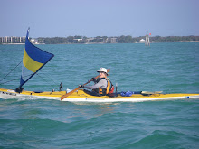
Don’t you just love it! Telling stories is probably the biggest rush behind blogging. And reading of folks’ paddling journeys and adventures is always a big part of that. And being able to tell your story with a map, adding in your GPS tracks, pointers to watch out for (good or bad), or clickable photos, just adds to the fun.
Truly, no person need be an island.
Chart above: "Sourced from Land Information New Zealand data. Crown Copyright Reserved." "NOT TO BE USED FOR NAVIGATION"
 Have to admit, I have a fetish for charts and maps (to name a few...).


2 comments:
It is truly amazing what can be done now. When I post photos now there is an interface that lets me select the location on Google maps that they were taken. Multiply that by a million people and things get interesting.
I am also a chart-o-hile. I may need to add on a room to store them all. I only hope that the gps does not replace the map, compass, and dividers. Folks still need to hone their 'paper' navigation skills rather than relying on electronics. Bad things can happen when electronics meet H2O.
Post a Comment