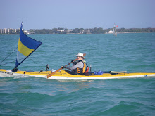
 Well, maybe it was the plan in the first place. Looks like she's turning into Shark River and going inside to CP3. 25 miles down in 8 hours. Working her way across Oyster Bay, Whitewater Bay and Coot Bay and then taking the Flamingo Canal, it looks like about 21 miles. I don't really know how this works, but KB never puts her body where her brain hasn't been--plans A, B, C....
Incidentally, if you're not using Google Earth, I encourage you to. This morning I discovered that the little blue dots are (mostly) photographs that pop up. I've been look at some of the scenes she's been enjoying. Coordinates at 12:57:
25.3427N, 81.1115W


No comments:
Post a Comment